
Project Description
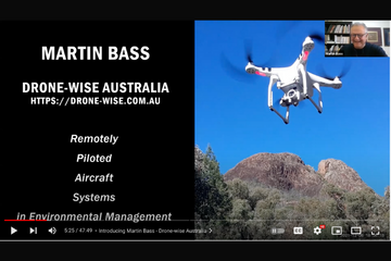
 The first speaker in a series of information sessions on tips & techniques for bush regenerators is Martin Bass from Drone-Wise Australia. Martin, an experienced aviator, commercial drone pilot and educator, enlightened us with the technical capabilities of drones.
Martin’s presentation provides an overview of the Types of Remotely Piloted Aircraft Systems (RPAS), how they are used in local government operations, including examples of photographic and video capabilities. Martin summarises the legal requirements of drone operations and the regulatory framework, providing a summary of CASA’s Standard operating conditions. The presentation concludes with an overview of the common risks.
A Question & Answer session provided an opportunity to address individual questions
At what time to watch it
00:00 Welcome and housekeeping
04:00 Introducing Martin Bass – Drone-wise Australia
06:00 Martin Bass – Remotely Piloted Aircraft Systems (RPAS) in Environmental Management
06:30 Background into the rise of drones
08:00 RPAS in Environmental Management
10:15 Types of RPAS
12:34 Multirotor RPAS
14:50 Fixed wing RPAS
15:40 How we use RPAS in land use management and local government operations
19:55 Examples of drone use – photo stitching
23:15 Examples of drone use – video recordings
25:41 Examples of drone use – still photo example
26:30 RPAS and the Law
30:10 CASA Standard Operating Conditions
34:00 Risk identification and management
35:45 Q & A
36:15 How much do weather conditions limit drone use?
37:40 In your experience using multispectral sensors for weed mapping. Are you easily able to identify weeds (noting each weed will have a different reflectance and some might be indistinguishable from indigenous species). If you are able to identify the weeds, are you analysing the data via the individual images taken or through a photogrammetrically stitched image?
41:50 We are interested in doing mapping (and potential management) of large rangelands properties. Particularly interested in stereoscopic and spectral image capture. From investigations we’ve done drones have limitations regarding line of sight, flight time / distances / bird attack and sometimes price when compared to fixed wing manned craft. What are your thoughts for working with large properties (e.g. 70km x 40 km etc)?
45:40 More information about
~ upcoming events https://www.aabr.org.au/events/
~ viewing recordings on https://www.aabr.org.au/regentv/ and
~ joining AABR https://www.aabr.org.au/about-aabr/joining-aabr/
47:50 Meeting ends
ADDITIONAL QUESTIONS ANSWERED BY MARTIN BASS
Q: I have a DJI Mini 2, and use my phone as the display screen… are there any larger viewing screens that you’d recommend? (Tablet/Laptop/etc)… particularly with the glare of flying during the day?
A: I have the same aircraft and have purchased a bracket for the controller on which to mount an iPad Mini. You’ll find all manner of brackets and mounting solutions on eBay.
Q: Flying under canopy?
A:To be avoided under most circumstances. Canopy above means a plethora of obstacles below it – tree trunks and branches, etc. It also may cause full or intermittent loss of your GPS signal so the drone will lose its orientation and stability. You can sometimes fly to the edge of a canopy and encroach a little into the covered area but under most circumstances, avoid it if you can.
Q:No Lidar on drones?
A: Lidar equipment that can be mounted on drones comes at a cost upward of $35,000. The drone that will carry it will typically cost in excess of $10,000. There are certainly Lidar units around and drones to carry them but cost is the most limiting factor – overall entry into this sector of the market costs $50,000 by the time you acquire all the necessary bits and pieces. Visit https://www.aabr.org.au/regentv/ for more videos for bush regenerators AABR acknowledges Australian Aboriginal and Torres Strait Islander peoples as the First Nations of this continent and recognises their custodianship and continuing connection to its land, waters and community. We pay our respects to the Elders past and present and future, for they hold the memories, traditions, culture and hopes of Indigenous peoples across the nation.
What are your thoughts for working with large properties (e.g. 70km x 40 km etc)?
A property of this size would require a fixed-wing drone to complete the task efficiently. Multirotor drones will only remain aloft for around 20-40 minutes per battery so you would need significant number of batteries and serious recharging capability. This would make the task very slow and expensive. By comparison, a fixed wing drone will remain aloft for anything up to three hours on a single battery, depending on the type, so this would be far more efficient under the circumstances.
In your experience using multispectral sensors for weed mapping, are you easily able to identify weeds (noting each weed will have a different reflectance and some might be indistinguishable from indigenous species). If you are able to identify the weeds, are you analysing the data via the individual images taken or through a stitched image?
Weed mapping and identification depends very much depends on what output you’re looking for and the software you use to do the analysis. Multispectral work in this regard often requires a number of people to be involved. I am responsible for operating the aircraft in the field and gathering the raw data 9 images in this case. However thereafter, a number of others are often needed as the skill sets required are highly specialised. Someone will be responsible for post-processing of the data to create the specific output required. In many cases, still more people are involved as there are often algorithms that need to be developed to enable machine learning in order to train the computer to identify specific targets – weeds or other specific vegetation. So to answer the question, the photo stitch is the easy bit – understanding the output, or training the computer to understand it, is where the complexities begin.
AABR acknowledges Australian Aboriginal and Torres Strait Islander peoples as the First Nations of this continent and recognises their custodianship and continuing connection to its land, waters and community. We pay our respects to the Elders past and present and future, for they hold the memories, traditions, culture and hopes of Indigenous peoples across the nation.
